Cala Sant Vicent Circular - Intermediate Route
A great trail to explore the towns and countryside in the north
Not for the faint hearted, this bike route will take you over Ibiza's second highest mountain, Sa Torreta, which stands at a height of 412m.
A good circular route that allows you to explore the towns, coastline and countryside in the north of the island. This is a physically demanding route that takes you over the second highest peak on the island and through farming land to the coast.
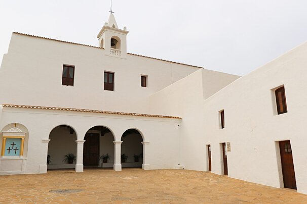
Starting off at the church, you will pass through some typical pine woodland, which explains why Ibiza and Formentera are known as the Pityuses, an ancient Greek name meaning “pine islands”. Ascending and descending you will go through orchards that are filled with almond trees, fig trees, carob trees and olive trees. The trail goes directly into the town of San Carlos, well known for the Las Dalias hippy market that takes place there on a Saturday. From here you will need to tackle a steep but short climb to Puig des Molí from where you then gradually descend towards the coast, arriving at Platja des Figueral (Fig Tree Beach) - a good spot for a quick dip in the sea!
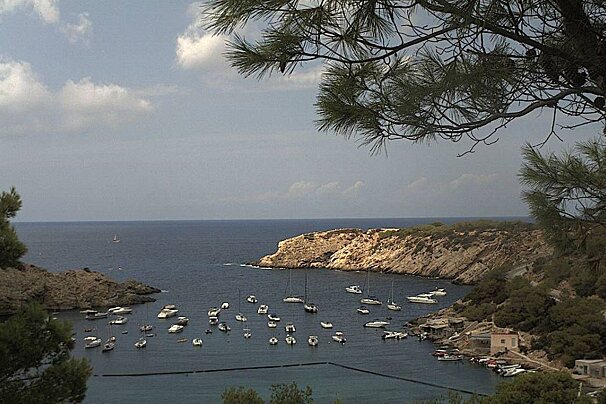
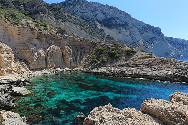
The coastal trail from here snakes along and leads you to Cala de San Vicent. This sandy cove is another ideal spot for cooling down in the water and enjoying a wonderful view of the sea and the small island of Tagomago. On the return journey to San Juan you will find yourself climbing up to the area surrounding the Portinatx lighthouse, the northernmost point of the island.
What to bring
As with all long bike trips you will need to make sure you have enough water for the duration, or at least to get you between towns where you can re-stock. Suncream is a must and remember to wear a helmet!
What to see
Sights in Ibiza
See all Sights & Sites-

Balafia Traditional Houses
Located 6.1 km away
Just outside the village of San Lorenzo in the north, there are echoes of an old Moorish settlement, seven houses and two towers with a distinctive defensive function
-

Cova de Can Marca Caves, San Miguel
Located 6.1 km away
These caves date back 100,000 years and contain various fossils and bone remains.
-

San Carlos Church
Located 6.6 km away
As the road winds around it, entering and leaving San Carlos, you can't help but be drawn to a quick stop to have a wander round.
-

San Miguel Church, San Miguel
Located 6.8 km away
Beautiful and simple church that is situated on top of the hill overlooking the town of San Miguel and the surrounding countryside.
-

Torre des Molar (Balansat Tower), San Miguel
Located 7.0 km away
Part of the wide network of watchtowers that dot Ibiza's coastline, Torre des Molar, also known as Torre de Balansat or Torre de Sant Miquel is located 95 metres above Port de Sant Miquel.
-

Puig de Missa Church
Located 10.4 km away
This stunning church is hard to miss as it's situated at the top of a high hill overlooking the whole of Santa Eulalia.
Where to lunch
There are plenty of options for lunch along this route, from the pretty little town of San Carlos and Las Dalias market if you are travelling on a Saturday, to the beach clubs and cafes of the coast and Cala San Vincente.
Restaurants in Ibiza
See all Restaurants-

Aiyanna Restaurant
This restaurant serves dishes with a modern take on fresh, healthy Mediterranean food, where bold flavours, organic produce and innovative sharing platters dominate.
-

Cipriani Downtown Ibiza Restaurant
Located in Ibiza Town
This restaurant is part of the Cipriani's brand, which started in 1931 with the infamous Harry's Bar in Venice. Their Ibizan restaurant serves a selection of international cuisine in a glamorous setting.
-

Tatel Restaurant
Located in Ibiza Town
Founded by partners Rafa Nadal, Enrique Iglesias, Cristiano Ronaldo and Pau Gasol, this restaurant in Ibiza is the third of a chain that opened in Madrid and Miami. They serve updated traditional Spanish recipes and boast a chic 1920's dining room with sea views inside the Hard Rock Hotel.
-

Eden Restaurant & Lounge, nr San Miguel
Located in the beautiful five star hotel Hacienda Na Xamena, the restaurant is perched on the edge of one of the hotel's swimming pools.
-

The Giri Cafe Restaurant
This restaurant is located in the main square of San Juan. Using only seasonal, locally sourced produce, they serve breakfast, lunch and dinner in a stylish dining room and a beautiful garden.
-

Ushuaia Beach Club
Located in Ibiza Town
The coolest chill-out music in Ibiza, the most exclusive ambience, quality cuisine and customer service that redefines the real meaning of VIP have turned this beach club into one of the most exciting places on the island, summer after summer.
What to do
Things To Do in Ibiza
See all Activities & Trips-

One Week Yacht Charter Itineraries
Experience the Balearic Islands your way with 212 yachts, using one of their sample itineraries or with a specialised itinerary created just for you, based on what you like and don't like, as well as their own expertise.
-

Luxury Chantella Yacht Trip
Located in Palma de Mallorca
Take a trip onboard this luxury yacht along the coast of Mallorca or Ibiza to any destination of your choosing.
-

Luxury Rehab Yacht Trip
Located in Palma de Mallorca
Take a trip onboard this luxury yacht along the coast of Mallorca or Ibiza to any destination of your choosing.
-

Luxury A4A Yacht Trip
Located in Palma de Mallorca
Take a trip onboard this luxury yacht along the coast of Mallorca or Ibiza to any destination of your choosing.
-

Luxury Jack III Yacht Trip
Located in Palma de Mallorca
Take a trip onboard this luxury yacht along the coast of Mallorca or Ibiza to any destination of your choosing.
-

Luxury To Escape Yacht Trip
Located in Palma de Mallorca
Take a trip onboard this luxury yacht along the coast of Mallorca or Ibiza to any destination of your choosing.
Directions
1. Departure. We depart from Sant Joan, taking an adjacent street heading east. We cross a small car park and carry straight on until we reach a trail that crosses underneath the road through a tunnel. We then follow a track that climbs to the right.
2. At the crossroads, straight on. A crossroads appears and we carry straight on, continuing our ascent up to a fork, where we veer right, next to a wall. We continue along the path that climbs next to a shelter and further up we take a trail to the right where the path forks, riding past a property with dogs.
3. At the crossroads, straight onto the track. We cross a track and reach the road, which we cross, continuing straight on along an ascending track.
4. Right fork. We reach a fork in the track and veer right, continuing our climb, where we can see a signpost for trekkers. We carry straight along this track until the next fork where we veer left.
5. Crossroads left. We reach a crossroads next to a water tank. We can either turn right and ride up to the summit or continue left in order to begin our descent and carry on with the route.
6. Left fork. We reach a fork and continue our descent leftwards along the main path. At the next crossroads we continue left along the track in our descent, ignoring all detours and continuing down the same track until we reach a road.
7. At the crossroads, straight on. We come out onto a road and carry straight on passing a house. At the next fork we veer left and then carry straight on.
8. Left fork. We reach a fork and continue along the road to the left until we come out at another road where we turn right before taking a track to the left. We then carry straight on taking no detours.
9. Crossroads right road. On reaching this road we turn right, passing by the Dalias street market and then turn left towards Sant Carles along the main road.
10. At the crossroads, left turn onto the town. On entering the town of Sant Carles we skirt around the church to the left and turn left next to Anita's bar before taking a track to the right which we ride straight up with no detours.
11. Crossroads straight on. Once we have reached the top of the slope we link up with the track and carry straight on. We reach a crossroads next to some ruins and carry straight on as far as another crossroads where we turn left and carry straight on until we reach a road where we turn right.
12. Turn to the left onto the track. At this point we turn left along a track, carry straight on, riding past a house, and link up with a trail that descends along a torrent before climbing and connecting with a path that leads to a track where we turn left.
13. Crossroads left road. We reach a road next to some houses and turn left, descending. At the next crossroads we go straight on and then to the right.
14. Turn left path. Before entering an urban development we turn left along a path that enters the woods. We reach a fork where we veer right before riding down to Platja des Figueral.
15. Detour left path. Having covered some 100 metres along the beach we take a path that climbs to the left and snakes around the cliffs. Further ahead we link up to a road and continue northwards.
16. Crossroads straight on track. We reach a crossroads and carry straight on along an earth track until we come out of the Aigua Blanca beach area and reach a crossroads with a road where we turn right towards La Cala de Sant Vicent.
17. Crossroads right. We reach a crossroads and turn right towards La Cala de Sant Vicent. Next to the seafront promenade we turn right and take a path westwards.
18. Right turn onto the path. We reach a trail on the right amongst the reeds and follow it. Further ahead we come out at a road and turn left before taking a track 100 metres further ahead that veers to the right.
19. At the crossroads, straight ahead. We reach a crossroads and carry straight on along the same track. At the next crossroads we carry straight on along a cement path and at the following crossroads we continue to the right.
20. At crossroads, straight on road. We cross a road and carry straight on. A few metres further ahead we reach a fork and carry on to the left. At the next crossroads we carry straight on, passing close to the town of Sant Vicent.
21. Detour left track. Before a bend we take a detour to the left along a woodland track. We reach a crossroads next to a well and carry straight on. We also carry straight on at the following crossroads.
22. Right fork. We reach a fork and continue rightwards. At the next fork we also continue to the right and about 100 metres ahead, at a bend, we take a path to the right, entering woodland.
23. Turn to the left onto the trail. At this point we turn almost 180 degrees and take a beautiful ascending trail with plenty of loose stone. One kilometre later we come out at a path and turn right.
24. At the crossroads, right turn. We pass by a series of farmhouses and reach a crossroads where we turn right. At the next fork we continue rightwards and 1 kilometre further on we reach another fork where we turn left and begin the bike trial.
25. Turn to the left onto trail. At this point we take a trail that comes out on our left and continue our descent. At the next three crossroads we carry straight on until we reach the road.
26. At the crossroads, turn to the left onto the road. We reach a road and turn left. We climb a rather steep section and then ride down towards Sant Joan.
27. Crossroads right town. We reach a crossroads and turn right, entering the town of Sant Joan.
28. End of the route. We complete the route next to the town church.


